


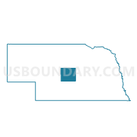
Grant Precinct, Custer County, Nebraska
About
Outline

Summary
| Unique Area Identifier | 612649 |
| Name | Grant Precinct |
| County | Custer County |
| State | Nebraska |
| Area (square miles) | 79.78 |
| Land Area (square miles) | 79.78 |
| Water Area (square miles) | 0.00 |
| % of Land Area | 100.00 |
| % of Water Area | 0.00 |
| Latitude of the Internal Point | 41.11168210 |
| Longtitude of the Internal Point | -99.98004450 |
Maps


Graphs
Select a template below for downloading or customizing gragh for Grant Precinct, Custer County, Nebraska


Neighbors
Neighoring Voting District (by Name) Neighboring Voting District on the Map
- Delight Precinct, Custer County, NE
- Elim Precinct, Custer County, NE
- German Precinct, Dawson County, NE
- Gillan Precinct, Dawson County, NE
- Wayne Precinct, Custer County, NE
- Wood River Precinct, Custer County, NE
Top 10 Neighboring County Subdivision (by Population) Neighboring County Subdivision on the Map
- Delight township, Custer County, NE (698)
- Gillan precinct, Dawson County, NE (475)
- Wood River township, Custer County, NE (326)
- German precinct, Dawson County, NE (261)
- Wayne township, Custer County, NE (140)
- Elim township, Custer County, NE (133)
- Grant township, Custer County, NE (61)
Top 10 Neighboring Unified School District (by Population) Neighboring Unified School District on the Map
- Cozad City Schools, NE (5,227)
- Broken Bow Public Schools, NE (4,934)
- Gothenburg Public Schools, NE (4,528)
- Callaway Public Schools, NE (1,294)